Ha Ling Peak, towering 1,100 metres over Canmore, is one of the Bow Valley’s most iconic mountains and epic hikes.
It’s more than just a challenging ascent; it’s a testament to Canmore’s rich history.
It was named after Ha Ling, a Chinese immigrant who first climbed it in 1896. Over the last 127 years, the peak’s story is filled with tales of bets, disbelief, and a handkerchief left at the summit as proof of conquest.
For over a century, the mountain bore the derogatory name “Chinaman’s Peak.”
After years of complaints, it was renamed in honour of Ha Ling. In 1997, we finally shed the racial slur and recognized the man’s remarkable achievement.
The Stoney Nakoda also have a name for this mountain – the Ehagy Nakoda Range.
Finding the Trail
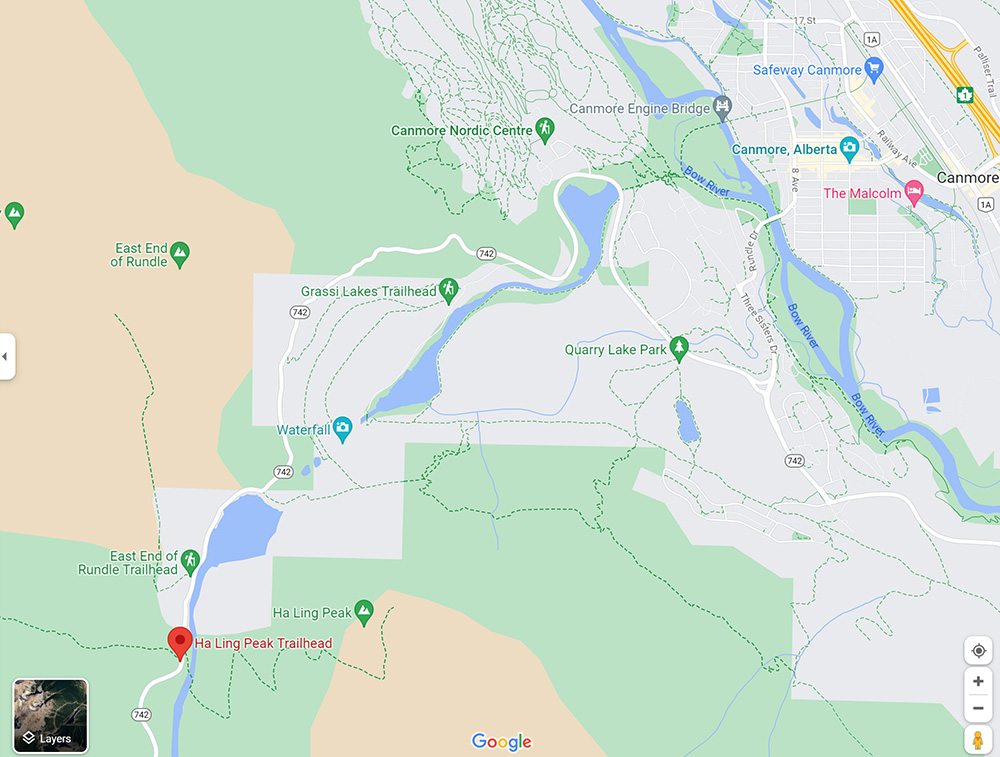
From downtown Canmore, make your way to the Three Sisters Parkway, passing the Canmore Nordic Centre along the way, and climb the steep road along Grassi Lakes until you get to the Goat Creek Day Use area.
In the past, the trail was something only locals knew about.
Now, it’s a well-marked and maintained trail with rock steps, chain handrails, three sets of wooden staircases, and upgraded infrastructure, ensuring a steady climb for novice and experienced hikers alike.
The hike to the summit and back is almost 8 kilometres and takes from three to five hours to complete, depending on your fitness and how much time you linger at the top.
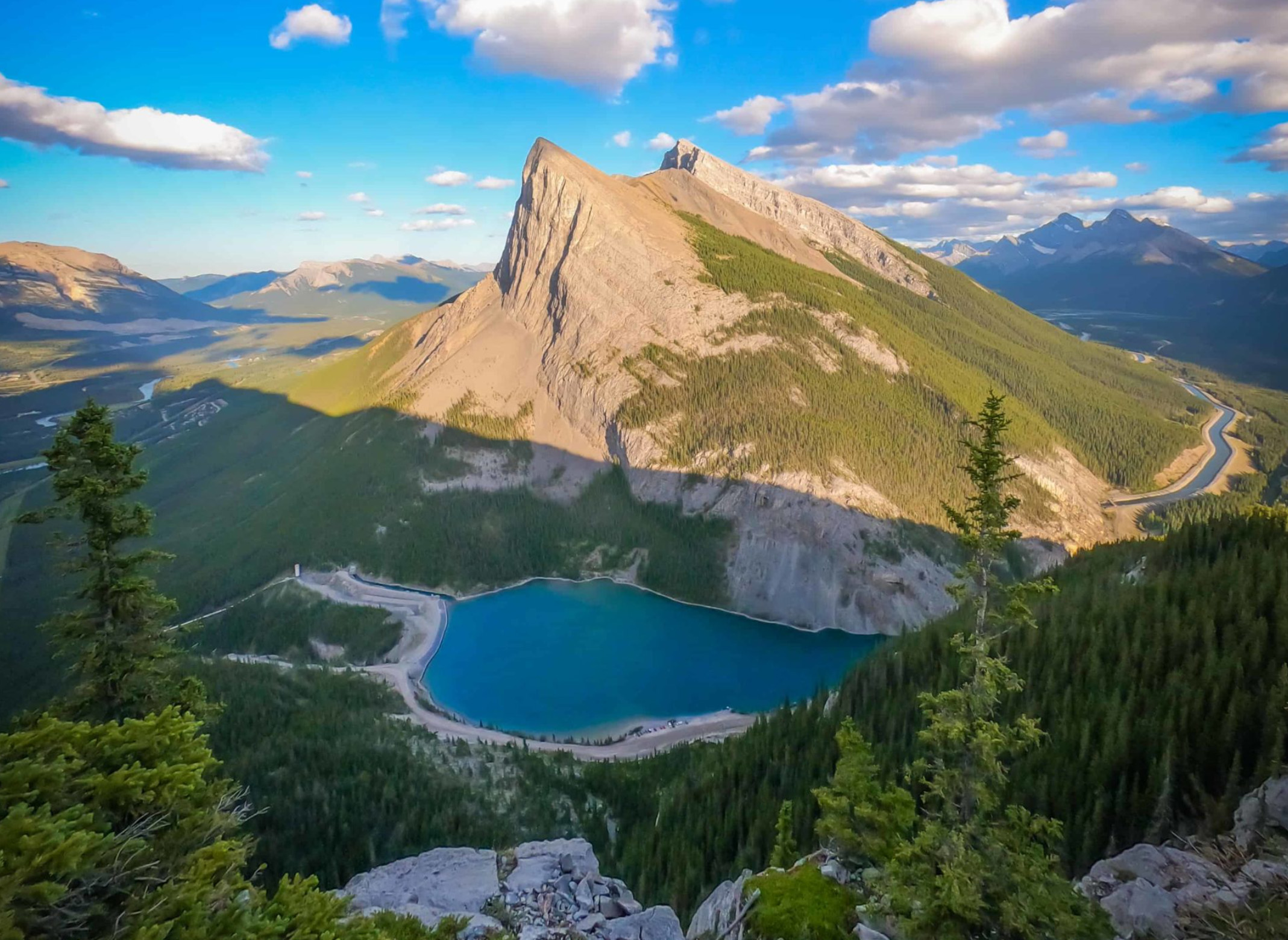
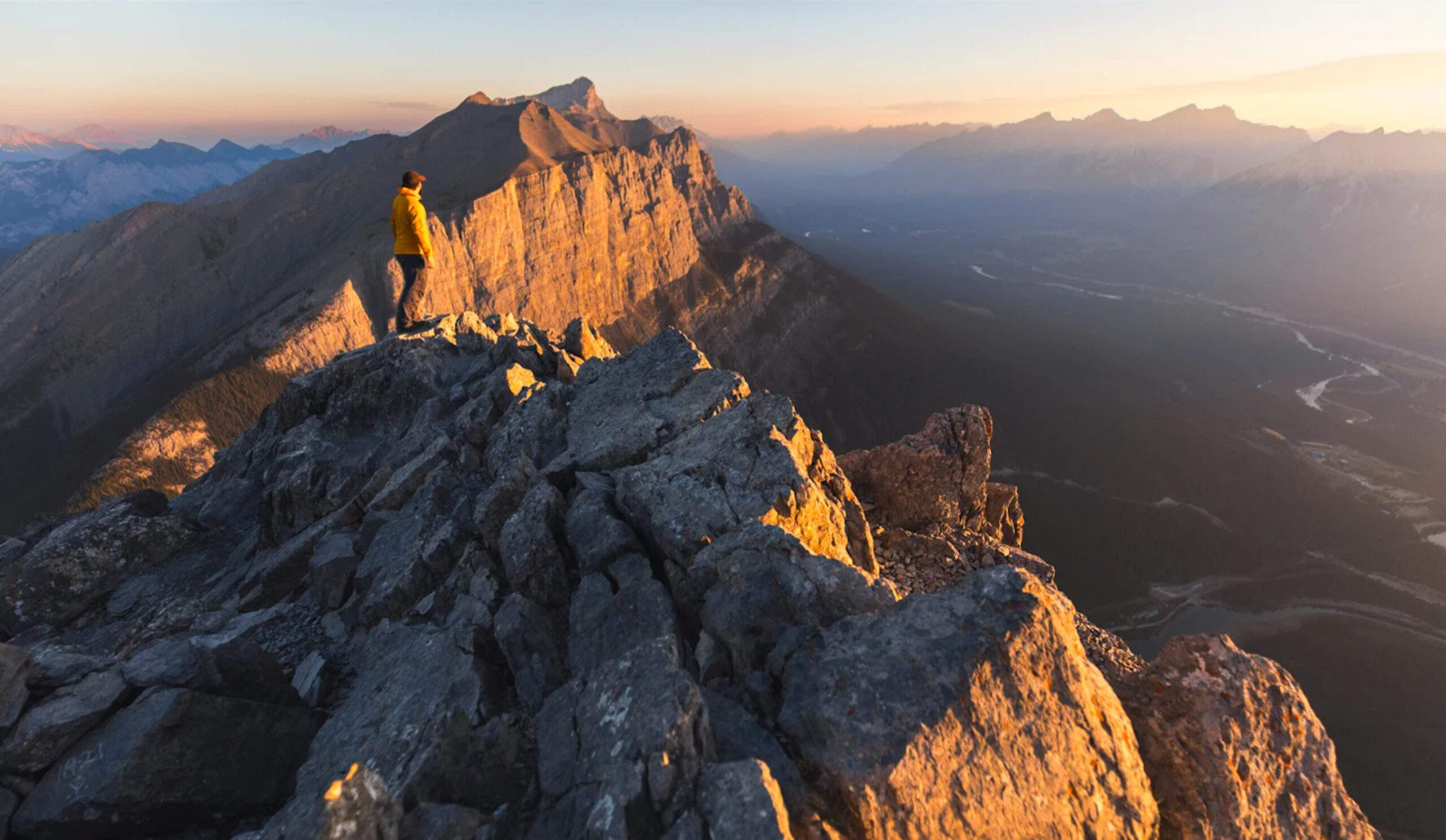
As you climb, you’ll be rewarded with panoramic views of the Bow Valley, a sight that has captivated adventurers for generations.
What to Expect
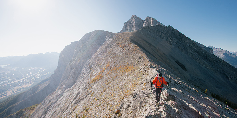
The hike is on a well-defined and developed trail, approximately 700 meters in elevation gain to the saddle.
From the saddle, the trail turns into a footpath that requires more care when hiking. The final stretch of 100 metres in elevation is a steep scramble, but the panoramic views from the summit make every step worth it.
Although many people hike the trail year-round, for most people, particularly novices, the hike is best tackled during the snow-free summer and fall.
Along the way, you’ll traverse through dense forests, cross rocky plateaus and avalanche slopes, and finally be rewarded with stunning alpine views.
Although you could possibly encounter local wildlife on the way, it’s more likely you’ll see a lot of fellow hikers. The trail is increasingly popular, especially with the upgrades to the path, which make the peak easier to climb.
Safety and Preparedness
Before setting out, checking trail conditions and weather forecasts is crucial. Equip yourself with sturdy footwear, bear spray, rain gear, a sweater for unpredictable mountain weather, sun protection, ample water, and snacks.
Remember, the weather in the mountains can change fast, going from sunny and warm to stormy in a very short time! Be prepared for any possibility.
Ha Ling Peak is more than just a hike; it’s a journey through Canmore’s history, a testament to human perseverance, and a celebration of natural beauty.
As you stand at the summit, take a moment to reflect on Ha Ling’s legacy and the countless footsteps that have tread the path before you.
To learn more about the big controversy of renaming the peak, watch the CBC News trailer below: